While there is no official Environment Agency Flood Alert for Salford as yet, Salford Council this morning issued a `regional flood risk' notice preparing for the "possible risk of flooding from rivers and surface waters over the next 36 hours", as 100mm of rain is forecast over the weekend.
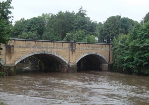
This afternoon, in the heavy downpour, the Irwell was raised to levels well above normal with the weirs near Whit Lane/Littleton Road and on Riverside in East Salford hardly visible.
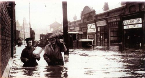
The Irwell Valley in East Salford is in the top five inland flood risk areas in the country. In 1860, Peel Park recorded floods between eight and ten feet, while in 2008 flood basins were used and the Irwell overflowed near the Lowry Hotel. The whole of Salford around both the River Irwell and the Manchester Ship Canal is classed in either a High Risk (1 in 100 years) or a Medium Risk (1 in 1000 years) area, with up to 5000 properties in danger of flooding in East Salford alone.
In Lower Broughton, the new River View school was built with an `escape route' for pupils, while new Countryside Properties houses in the area have been using marine plywood for fittings, with sockets half way up the walls in preparation for flooding.
The Salford Council notice is both for flooding from the River and from overloaded sewers and drains.
Anyone concerned about surface water flooding can contact Salford City Council on 0161 909 6505 or 0161 794 8888 or go to http://www.salford.gov.uk/flooding.htm for more information.
You can also contact Floodline on 0845 988 1188.
The latest flood alerts and warnings are available from the Environment Agency: click here
Twitter: @envagencynw
Facebook: Sign up for flood alerts via Facebook www.facebook.com/floodalerts
See also how Peel Holdings took on the Environment Agency to move its land on the banks of the Manchester Ship Canal from a High Risk flood area to a Medium Risk flood area - click here
Our main photo shows the weir on the River Irwell near Littleton Road taken at 1pm this afternoon.


.JPG)
.JPG)
.JPG)
.JPG)
.JPG)
.JPG)
.JPG)


.jpg)


.jpg)
.jpg)
(3).jpeg)
.png)
(1).JPG)
