It's taken over eight months for the official Section 19 Greater Manchester Flood Investigation Report to be published – and, for the Salford Boxing Day Flood, it reaches the incredible conclusion that it was caused by "high levels of rainfall"...
"Flooding occurred when high levels of rainfall caused the River Irwell to overtop raised defences and natural bank levels and exceed the capacity of the surface water network" it states, adding that "The flood level was exacerbated by debris blockage as the river flowed beneath Hough Lane footbridge..."
And that's really about it. There's no mention of the affect that new Lower Broughton properties might have had on the torrent; nor is there anything about the `boulders in the Irwell' theory that many residents put forward.
Meanwhile, Peel Holdings is totally exonerated. Many believed, as they did in the big flood of 1946, that the Quays and Media City (the Docks back in the day) were saved from flooding at the expense of social housing in Lower Broughton. But the report, which Peel Ports helped to produce, states that the Manchester Ship Canal (which Peel owns) did not have any impact on the Spike Island flood...
"Hydraulic modelling of the flood event conditions indicate that the water levels upstream of the canal, at locations where flooding was experienced, were independent of water levels on the canal" it explains "How the canal was operated therefore did not affect those communities that flooded upstream.
"At Broughton, the location to flood from the River Irwell closest to the canal, the water levels were dictated by the size of the flow and the obstruction to this flow caused by Hough Lane Footbridge that was increased during the event by debris being trapped against it" it adds.
Apart from stating that the River Irwell Flood Warning Area (Salford Area B GM2B) is currently being reviewed, there's not a lot else in the report that sheds much light on what happened. It's not so much a whitewash as a `no wash'. So Lower Broughton residents will have to wait for yet another "more detailed" report from Salford City Council which is promised to have "further details of investigations and possible next steps". The Salford Star understands that this is imminent.
Meanwhile, the Greater Manchester Flood Investigation Report is full of details about the effects of the flood and the response, which residents know only too well – 750 properties were affected in Lower Broughton (the highest number in Greater Manchester), with 250 affected by power loss. There was also severe electrical damage to the Environment Agency river flow/level gauging station at Lower Broughton,`which provide information to trigger flood warnings for properties nearby'.
Elsewhere in Salford, flooding was `experienced' outdoors at Salford Quays `with damage to the Helly Hansen Watersports Centre pontoons'; the flooding also caused `damage to river walls and walkways at the rear of the Soapworks site, erosion to the abutment of a footbridge in Clifton Country Park and deposited large amounts of debris along the banks of the river Irwell'; and `a substantial amount of debris was washed down from the upper reaches of the Irwell catchment, large amounts of which were deposited in Salford along reaches of river bank and also at Media City...'
The Environment Agency's gauge in the River Irwell off Littleton Road, at the so-called `Manchester Racecourse', recorded a river level of 5.67metres, which is 1.3metres higher than any other reading in its 75 years of recording... "This river level is estimated to have a likelihood of occurring only once in 100 to 150 years" it states.
The only conclusion for Salford within the report is that "Construction of a second flood storage area at Castle Irwell will finish in autumn 2016 and this will reduce flood risk to approximately 1,900 homes and businesses in Lower Kersal, Lower Broughton and Cheetham".
As far as the causes of the flood go, the report gives a strong indication that climate change was a factor, without spelling it out...
"2015 was the sixth wettest year on record" it states "December's weather was substantially warmer than normal and this warmer air carried more moisture resulting in twice the long-term average December rainfall total, creating saturated catchment conditions over large parts of the Irwell catchment. The heaviest rain from Storm Eva on Christmas Day and Boxing Day was experienced over Pennine areas, mostly North of Manchester. In the preceding days, soils in these areas had become saturated and close to capacity.
"The combination of prolonged average rainfall, saturated catchments, rapidly responding rivers and heavy showers on and around the 26th resulted in an extremely rapid onset of flooding" it explains "The sheer speed of response made the flooding very difficult to predict, and placed a huge strain on the relevant authorities and responders and their ability to co-ordinate pre-emptive activities. Water levels rose rapidly in the Rivers Irwell, Roch and Glaze.
"The sudden onset, extent and depth of the flooding was unprecedented and meant that its impacts across Greater Manchester were devastating" it concludes "Depths were so great in parts of Bolton, Bury, Salford and Rochdale that some residents were evacuated by boat, tractor and wheelie bin. For some areas this was the worst flooding for a generation."
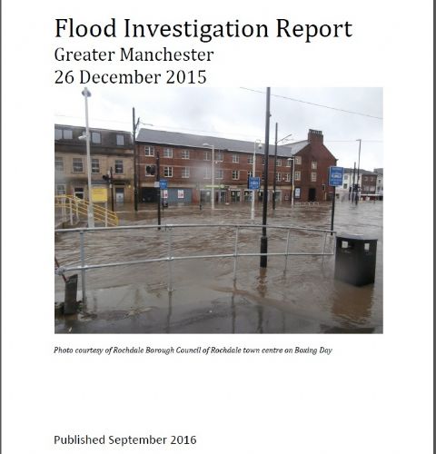
To read the full Greater Manchester Flood Investigation Report – click here
See also previous Salford Star article - Government Flood Review Is Just 145 Pages of Waffle - click here




.jpg)


.jpg)
.jpg)
(3).jpeg)
.png)
(1).JPG)
